South Korea is an island! Geographically-topographically, this is a false statement, especially since the Korean Peninsula in the extreme east is part of the Euro-Asian landmass. Politically and practically, however, the statement has been correct since the end of World War II. Anyone traveling to South Korea can only do so by sea or air, not by land. The reason for this is the division of the peninsula, which was formally completed on September 15, 1945. How did it come about?
After a de facto takeover in 1905, Japan formally annexed the Kingdom of Korea in 1910, dissolving the Joseon dynasty that had ruled since 1392. Korea, like Taiwan, became a colony of the Japanese Empire, which it remained until August 15, 1945 (Japan’s surrender at the end of World War II). However, the surrender of the occupying power, hated in Korea, did not lead to liberation and restoration of territorial integrity. It instead created a division which continues to this day, making Korea the only country still divided on the planet. This division was not the intention of the warring allies, the USA and the Soviet Union, but resulted in the same as post-war Europe with its occupation zones of the former territories of the Third Reich. Korea was regarded as part of the Japanese empire, especially since there were no independent state structures in Korea.
Based on a proposal hastily worked out in Washington and subsequently accepted by Stalin, the 38th parallel was established as the dividing line of the two trust territories or occupation zones. It was strictly implemented on September 15, 1945. After both the U.S. and the Soviet Union introduced leaders loyal to their respective zones (Syngman Rhee from the U.S. to the South and Kim Il Sung from the Soviet Union to the North), both occupying powers withdrew relatively quickly from the bulk of the formations, especially since Korea was not of high importance to either. The continuation of the story is well known and culminated in the massive military attack by the North, which was sustainably rearmed and trained by the Soviet Union, in the Korean War on June 25, 1950.


After tough negotiations lasting over two years, a military armistice was signed at Panmunjeom, the site of negotiations, on July 27, 1953. The mutually recognized front line was designated on that day as the Military Demarcation Line (MDL) and defined with markers in the terrain. To this end, 1,292 markers with warning signs were placed on both sides along the 241 kilometers between the west and east coasts. These markers remain to this day as the only indications of the course of the dividing line between the two Koreas.


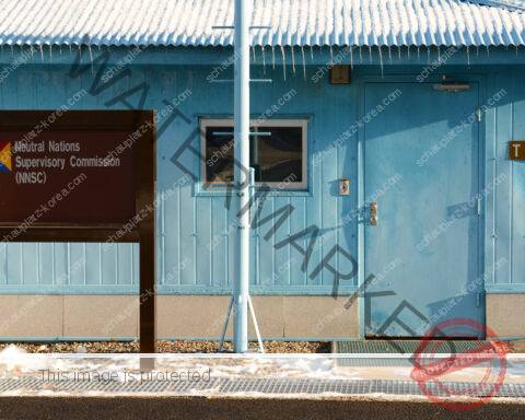
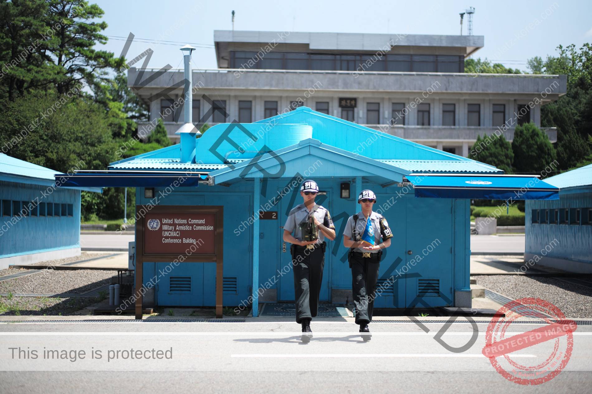
Within 72 hours of the signing of the agreement (10:00 a.m. local time), both sides were to withdraw all troops at least 2,000 meters in direct line with the MDL. This was implemented smoothly, but not without, at the same time, heavily mining the abandoned territory to make it impossible for the enemy to seize it. This created the De-Militarized Zone (DMZ), which is still in effect and highly visible today. Panmunjom remained as the only access and meeting place. Authorized persons from both sides could move freely there in the Joint Security Area (approx. 1 km2) until the serious incident of August 1976. Thus, a land strip of about 1,000 km2 (241 km wide and 2×2 km deep) was created, which theoretically should continue to be untouched. Based on satellite images, however, it is assumed today that “only” about 650 km2 are still untouched. The rest is accessible again due to the “re-militarization” of the DMZ that began in the 1970s, although always under more or less acute danger of mines. After the implementation of the withdrawal of both sides at the end of July 1953, the agreement stipulated that a maximum of 1,000 police officers each, equipped with small arms, were to remain in the DMZ for surveillance and protection purposes. A few days later, the MAC Joint Armistice Commission decided that military police personnel would also be allowed to do this but must be marked with a black (north side red) armband. On the south side, this is still the case today, but there are considerably more so-called military police, who are regular members of South Korean infantry divisions, in the DMZ today. The situation is similar on the north side.


These initial steps of “re-militarization” received additional momentum in the 1970s, with both sides erecting and operating fortified and armed watchtowers and observation towers within the DMZ as well. While there are well over 100 installations on the southern side, the number on the northern side is probably double that. In addition, as respective “countermeasures,” more and more powerful weapons systems were introduced, far beyond the authorized small arms. Thus, the “Demilitarized Zone” developed over time to the “highest-militarized demilitarized zone of the planet” of today. In this context, of course, the large military potentials of both sides must be taken into account, which are located immediately outside the DMZ and, depending on the level of tension, are kept in a very high state of readiness. Recently, many South Koreans, even in state institutions, have complained that they are denied access to the DMZ or that they can only enter with the permission of the American-led United Nations Command (UNC). According to the armistice agreement, the DMZ on the south side is “territory” of the UNC, although geographically it is part of the Republic of Korea. This is often difficult to understand and comprehend, especially for South Korean politicians. However, “normal citizens” of any origin are actually denied access to the DMZ from the Korean-controlled civilian control line, which extends about 5 to 10 km south of the DMZ, depending on the terrain, and marks the restricted military area up to the DMZ.

From a relatively new perspective, the DMZ land now presents a remarkable situation. Despite the military encroachment and restrictions in the DMZ, very diverse flora and fauna, containing a variety of unique species, developed over the nearly 70 years in the parts of land that have remained untouched since 1953. If lasting peace or the reunification that many long for were to one day occur in Korea, the DMZ would face a very different challenge than it has before: clear it, preserve it in part, or make it accessible? The impact on the DMZ’s distinctive flora and fauna would be correspondingly drastic. We are (unfortunately) not yet there!